
SRML station photos: Eugene, OR
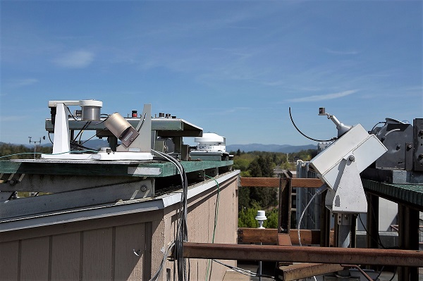
| The Eugene monitoring station. In the forground is the sun tracker. On the tracker are direct normal, global, and diffuse sensors. The shadeballs cast a shadow on the diffuse sensor In the background are various other sensors. |
| Auxiliary sensors for the Eugene station. The multifilter rotating shadowband radiometer is shown on the left. On the right is the rotating shadowband radiometer. The spectroradiometer is visible in the background. |
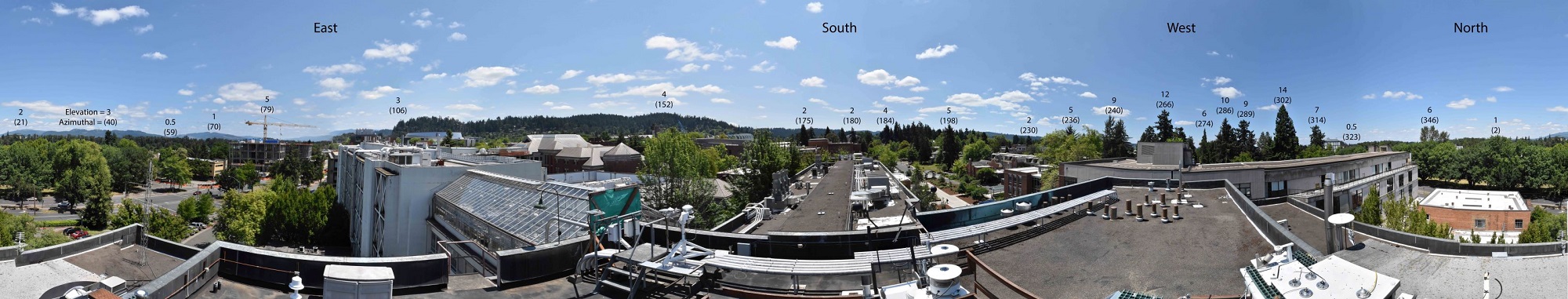
| Panoramic view of the surrouding skyline from the Eugne station. The Eugnee station has excellent views of the sky to the east and south. The view to the west is not ideal with the trees extending up 10 - 15 degrees. The approximate elevation angle and aziumuthal anlge of predominate features of the skyline are denoted in the picture. NOTE: the unceratinty the zenith angle is +- 1 degree. The uncertainty in the azimuthal angle is +- 2 degrees. Due to distortion effects in taking the photograph, the horizontal locations in the photograph are not to scale. |
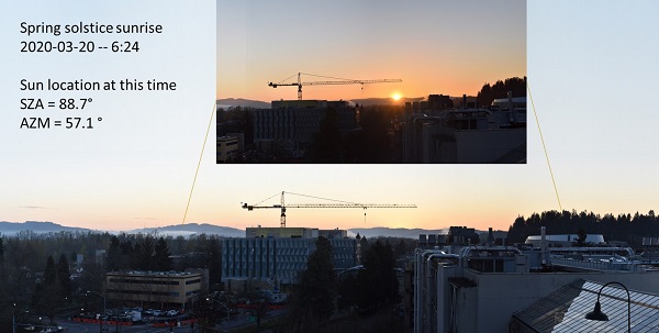
| Sunrise near the spring solstice from the Eugene station. The main photograph shows the entire eastern horizon just before sunrise. The inset shows the exact location of the sunrise relative to the larger horizon view. The crane visible in the sky is used in the Knight campus construction. The sunrise time and solar location for this day is given in the text box. |
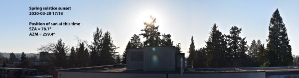
| Sunset near the spring solstice from the Eugene station. The Eugene station has trees to the west. The trees extend to varying degrees into the sky. This photograph was taken when the sun entered the trees. From this time onward, the sun is in the trees. At differnt times of year, the sun will set at different azimuthal locations. We are currently working on flagging the trees as permenant obstructions. The sunrise time and solar location for this day is given in the text box. |
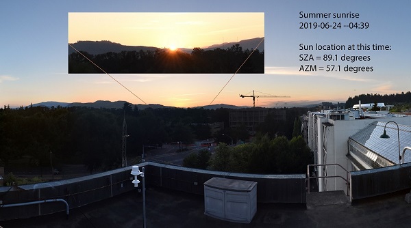
| Sunrise near the summer solstice from the Eugene station. The main photograph shows the entire eastern horizon just before sunrise. The inset shows the exact location of the sunrise relative to the larger horizon view. The crane visible in the sky is used in the Knight campus construction. The sunrise time and solar location for this day is given in the text box. |