
SRML station photos: Hermiston, OR
The Hermiston Oregon monitoring station. The automatic tracker is shown on the right. On the tracker are direct normal, global, and diffuse sensors. In the center of the photo is the rotating shadowband pyranometer. To the left are the AgriMet global and diffuse sensors.
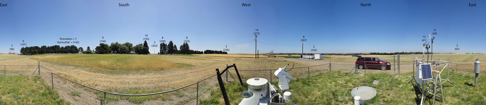
Panoramic view of the surrouding skyline from the Hermiston station. The trees to the southeast and telephone poles to the west affect the data at certain times of year near sunrise and sunset. The approximate elevation angle and aziumuthal anlge of predominate features of the skyline are denoted in the picture. NOTE: the unceratinty the zenith angle is +- 1 degree. The uncertainty in the azimuthal angle is +- 2 degrees. Due to distortion effects in taking the photograph, the horizontal locations in the photograph are not to scale.