
SRML station: Burns, OR
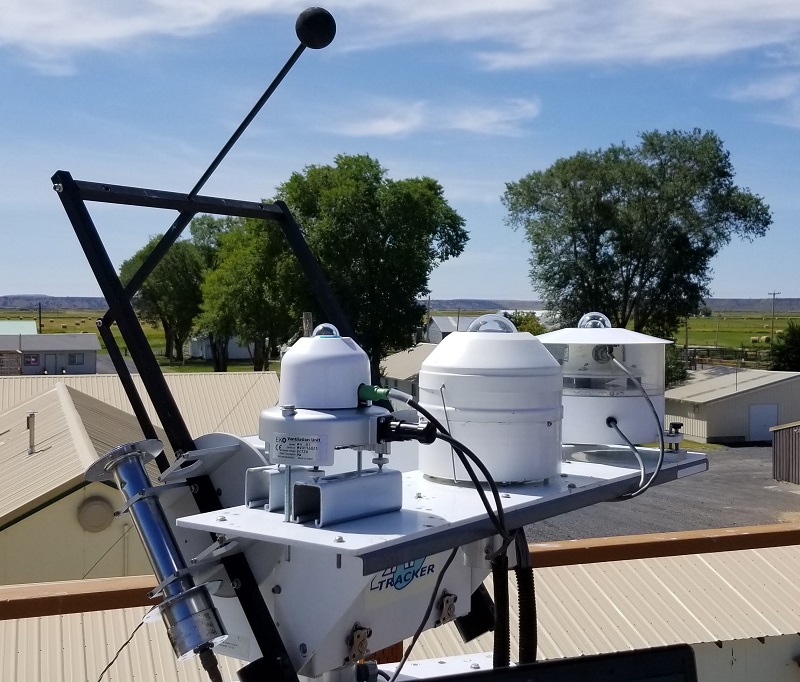
The Burns Oregon monitoring station. The automatic tracker is shown on bottom. On the tracker are direct normal, two global, and diffuse sensors. The shadeball is casting a shadow on the pyranometer in the center. The two pyranomters on either side are making global horizontal irradiance measurements.
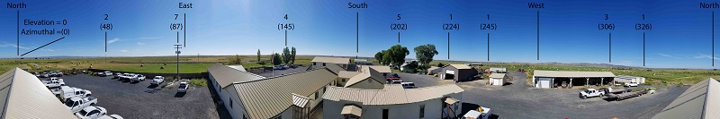
Panoramic view of the surrouding skyline from the Burns station.
Burns has an excellent view of the surrounding skyline.
The telephone pole to the east affects the sunrise data in spring and fall.
The approximate elevation angle and aziumuthal anlge of predominate features of the skyline are denoted in the picture.
NOTE: The unceratinty the zenith angle is +- 1 degree. The uncertainty in the azimuthal angle is +- 2 degrees.
Due to distortion effects in taking the photograph, the horizontal locations in the photograph are not to scale.
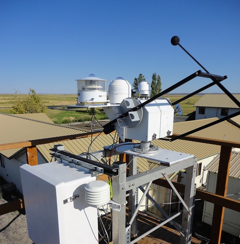
Looking Southeast at the Burns monitoring station. The support structure for the tracker is visible along with the temperature sensor and the data logger control box. In the background, the rooftops of surrounding buildings are visible. The station is above the surrounding obstructions.
© 2022, UO Solar Radiation Monitoring Laboratory
Last revised: 2022-03-15
Home page: solardata.uoregon.edu