
SRML station: Salem, OR
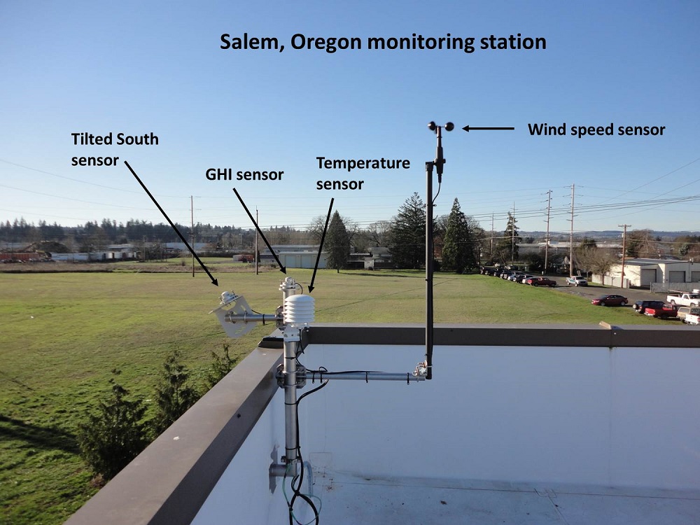
The Salem Oregon monitoring station. Looking west at the Salem, Oregon, monitoring station. The Salem station has a global horizontal pyranometer and a pyranometer sensor facing south at an angle of 30 degrees from vertical. The station also has temperature and a wind speed sensors.
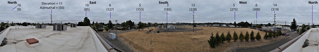
A 360 degree view from the station. The approximate locations of North, East, South, and West are labeled.
The elevation angle of prominate features on the horizon are labeled. All elevation angles are approximate. The station is located in the Southwest corner of the building roof.
This is why the two walls project to the East and North.
The approximate elevation angle and aziumuthal anlge of predominate features of the skyline are denoted in the picture.
NOTE: The unceratinty the zenith angle is +- 1 degree. The uncertainty in the azimuthal angle is +- 2 degrees.
Due to distortion effects in taking the photograph, the horizontal locations in the photograph are not to scale.
© 2022, UO Solar Radiation Monitoring Laboratory
Last revised: 2022-04-05
Home page: solardata.uoregon.edu